My wife prefers the center or aisle, so I sat in the window seat. We thundered up, the plane banking sharply, and soon reached our cruising altitude. We thought about getting comfortable, unfolding our dull trays to receive the snack, watching a movie to kill time for the two-hour trip stretching ahead of us. I glanced through the oblong window. What about the land slowly unfurling below, endless, like a painted scroll?
Take a good look down next time you're flying. Through casual observation, you'll be surprised by what you can learn about America: its fields and subdivisions, its mountains and dammed-up rivers, its strip malls and military outposts. From the air, everything's bare. You can see the land bathed in a rose-gold wash around 7:30 on a summer eve, and below, the origins of towns make themselves clear. You see the lids and bald spots of our made world and the patches of nature caught in between.
On a clear day with few clouds, you can watch each pattern of creation, each tidy parcel and house color-coded and blocked like a faded board game running beneath you, away from the belly of the plane.
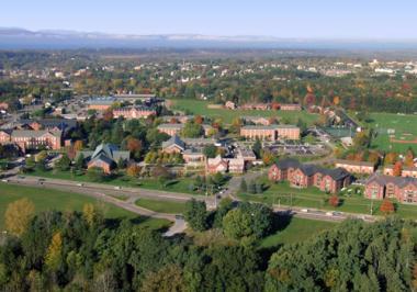
I was flying recently from Manchester, New Hampshire to Pittsburgh, and our flight path took us directly over my home town. The afternoon was calm and bright, and though we flew at 37,000 feet, it wasn't hard to spot the familiar landmarks of Brattleboro spread out like a dinner picnic: the two bridges spanning the Connecticut River north and south of my small town, with its four main streets and five steeples, and the surrounding development blossoming out. Even the Catholic church two blocks from my apartment was easy to see.
Our course took us due west, and I soon saw the road I take to work each day, Route 9. wending its way west up the foothills of the Green Mountains, past Marlboro College and onwards towards the New York border. When the plane passed Bennington, a town I vaguely know, I was able to pick out the white obelisk of the Bennington Battle Monument, but soon we were headed west of my regional know-how, towards Albany and beyond the confines of my corner of the world.
Later in the flight, one town's history laid itself bare in a instant. Somewhere over western Pennsylvania I saw a square-block village center, mostly houses and a compact Main Street—a perfect grid, as if laid out from an engineer's specifications, pre-assembled, and dumped down at once. This was surrounded by more chaotic commercial and residential development ringed further by helter-skelter industrial parks and strips. The original main road, now probably called "Old Route Something," still threaded the needle of downtown, but its glory had been usurped by the bypass, which feinted right then left then right again around the town like a running back.
The writing was on the wall, or rather the blackboard, below. I wondered about the fate of that town's Main Street, how well it was faring in the wake of the 24-hour mini-marts and discount outlets sprouting on the bypass, and how or if the citizens were rallying.
Outside Chicago, socioeconomics stratified like the kinds of clouds we passed through. Some well-to-do suburbs had in-ground pools shaped exotically into kidneys and ovals; other subdivisions sported utilitarian, above-ground circles. Other suburbs had no pools. This stately subdivision abutted a Rorschach golf course, while just a few hundred yards away, middle- and working-class row houses sat right behind shopping malls. Developers tried to hide their handiwork by sticking a fine line of trees between the respectable homes and an abandoned chemical plant. If this approach was halfway passable on the ground, from the air it was a failure. You could see right through it.
People complain about air travel because, they say, you don't get to "see the country." For me, it's just a different kind of seeing, speeded up, dramatized—a two-hour movie taken in an afternoon, not a thousand-page novel read over a week-long train trip. Through the transparent air on a cross-country flight I watch colors and shapes morph, as in a science class time-lapse film. Greens and blues of the East and Midwest blend into the ochres and burnt siennas and ruddy stretches of the Continental divide and the Western dry lands. Is that gray lump a lake, or a rocky peak? Will that old mall survive the new? How long before that forest grows back? From the air, you muse about geology, urban planning and abstract painting all at once.
My wife and I, we're in high, high chairs. Our public works are scratches, grids and puddles, splotches of strained carrots and beets, dropped forks and knives impaling fields, rusted drinks spilling in winding snakes from broken bottles.
Ethan Gilsdorf contributes regularly to the Boston Globe, the New York Times, National Geographic Traveler, and the Christian Science Monitor. He has also written for Psychology Today, Fodor's travel guides, and the Washington Post.


